

October 21, 2026 | City Council The Council upheld Riverwalk’s approval, 11 to 0. The vote decided the appeals. It did not answer the questions on this page. What the Council decided
Evacuation safetyWhen everyone needs to leave, where do they go?
Riverwalk would add 814 apartments and commercial activity along Ventura Boulevard.
That same corridor serves existing neighborhoods and the hillside communities south of the project.
During a major emergency, evacuation demand extends beyond any single building or parcel.
We want the City to show how the surrounding road network can accommodate that combined demand.
21 minutes for one road segment. More than six hours for the area.
Two evacuation analyses are now in the Riverwalk record. They do not measure the same thing, and their numbers should not be read as competing estimates of one event.
Read side by side, the studies answer different questions. The developer’s study calculates how long the project’s own vehicles need on one stretch of road. Jensen Hughes models the network that hillside residents, existing neighbors and new residents would all be using at the same time.
Jensen Hughes also maps constraints that exist before anything new is built: hillside homes more than a mile from an exit, neighborhoods of more than 30 homes served by a single access road, and neighborhoods with too few exits for the homes they serve.
Neither number is a City finding. That is the problem. The wider study is in the City’s own record, and we could not find a written City analysis of it.
What the developer’s study actually says
The full study is Exhibit A to the applicant’s October 7 letter in Council File 26-1081-S1. Page numbers below are the study’s own.
- CoverMarked DRAFT and dated September 2026. The applicant’s October 7 letter and October 13 presentation describe it as dated August 2026.
- Page 34The 21-minute estimate “represents only vehicles associated with the Project.” The study adds that real conditions “would likely differ from this conservative high-level Project-only estimate.”
- Page 31It assumes that “normal traffic from non-evacuating areas would not utilize the designated evacuation routes.”
- Page 34Whether surrounding neighborhoods are also evacuating appears only in a list of factors that would change the result. At PLUM, the applicant’s presentation said the study analyzes it.
- Page 21Its evacuation plan table is introduced as “The Gateway Center Project P.A.C.E. Evacuation Plans,” the name of a different project.
The City’s answer: the study does not change the findings.
“Under state-mandated rules per AB 130, the City is operating within a limited timeframe to act on this project and is unable to impose additional requirements at this stage.”
“The additional analysis provided by the Jensen Hughes study does not change the Planning Department’s ability to make the findings required for project approval.”
Council District 4 Planning and Community Development Director, email reply to a resident, October 19, 2026. Quoted as received. The reply is not posted in the Council file.
The same reply lists project-level requirements: a 30-foot two-way driveway and a 20-foot queuing reservoir required by LADOT, 28-foot access for aerial ladder trucks and a 150-foot maximum travel distance required by the Fire Department, a new signalized intersection and crosswalk enhancements on Ventura Boulevard, and funding for safety improvements at Whitsett and Moorpark.
Those requirements concern how fire crews reach the buildings and how cars leave the garage. They do not show how Ventura Boulevard and the hillside streets perform when new and existing households leave at the same time.
City Planning’s written response to the planning appeal is dated October 5, three days before the Jensen Hughes study, and does not mention it.
The Council voted on October 21. As of that date, we could not find a written City analysis of the Jensen Hughes findings in either Council file. The record does include project-level fire access review by the Fire Department and the applicant’s consultants.
If the study does not change the findings, the basis for that conclusion belongs in the public record.
Four questions. Still no written answers.
On October 19, residents sent Council District 4 these questions and asked that written answers be placed in the Council file before the Council voted. The Council voted on October 21. We could not find written answers in either Council file, and we will publish any we receive.
- Has City Planning or the Fire Department reviewed the Jensen Hughes study and responded in writing? If the study does not change the required findings, what is the basis for that conclusion?
- Driveway, fire lane and aerial access requirements show that fire trucks can reach the buildings and that cars can leave the garage. How do they answer what happens on Ventura Boulevard when new and existing households leave at the same time?
- The appeal states that the applicant’s own consultant identified hose pull gaps beyond the 150-foot limit: 28 feet at Building 4 and 17 feet at Building 2. Do the final plans eliminate them, or did the Fire Department approve a modification?
- Can any of the applicant’s contributions, or other City funds, go to evacuation access at Whitsett, Ventura and Sunswept and the hillside streets above them?
Residents also asked the Councilmember to introduce a motion directing the Emergency Management Department, the Fire Department, LADOT and City Planning to report on evacuation capacity for the Ventura Boulevard corridor and the Studio City hillsides.
The hose pull figures come from the appeal, which attributes them to the applicant’s own consultant. The records we reviewed do not show whether the final plans close those gaps or whether the Fire Department approved a modification.
Written comments filed after the PLUM hearing make the same requests: an independent corridor evacuation analysis and a formal response to the Jensen Hughes study.
A building exit is not an evacuation route.
A building's emergency design is important.
So are the streets people must use after leaving.
During a major wildfire, earthquake or other emergency, people may need to travel through intersections and roads also needed by emergency vehicles.
An assessment of a building's fire access does not automatically answer how the broader neighborhood will evacuate.
The people already here must be part of the plan.
The hillside neighborhoods south of Ventura Boulevard rely on connecting streets leading toward the main corridor.
Their evacuation needs should be considered together with the additional demand created by Riverwalk.
The issue includes road access, potential congestion and the ability of emergency responders to travel through the area.
We believe these concerns deserve direct analysis.
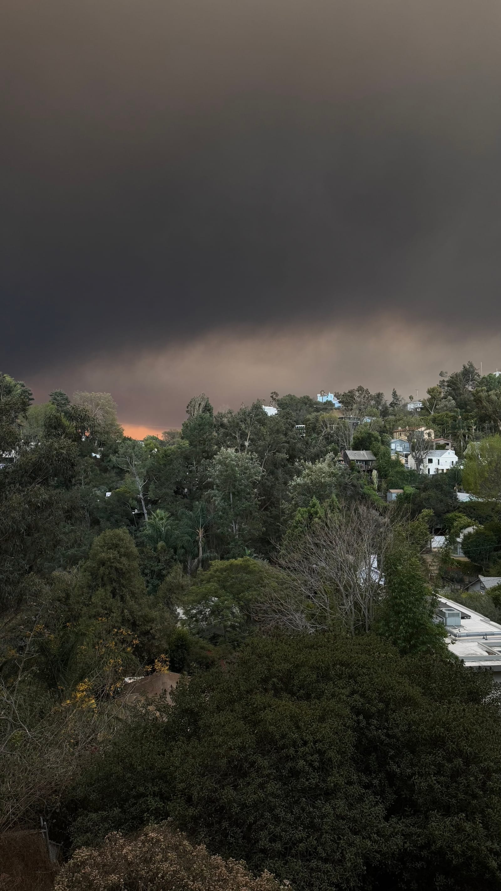
The City has fire access documents and a wider evacuation study. We want its answer.
The Council record includes a November 12, 2025 Los Angeles Fire Department letter outlining project access requirements.
It also includes a September 26, 2025 fire protection technical memorandum prepared by Dudek for the applicant's project team. It addresses fire code requirements, apparatus access, water supply and wildfire protection measures. It is a different document from Dudek's draft evacuation study.
Since the appeal, the record also includes the Jensen Hughes wildfire evacuation analysis, the applicant's response with Dudek's draft evacuation study, and the conditions of approval the City Council adopted on October 21.
Our request concerns corridor-wide evacuation demand and how the existing population and proposed development would use the surrounding streets during an emergency.
- October 8, 2026 Jensen Hughes Wildfire Evacuation Analysis Prepared for the appellants’ attorneys, filed October 12 in Council File 26-1081-S1. The study follows the appeal letter. View the filing (PDF, 75 MB)
- Draft, September 2026 Dudek Qualitative Wildfire Evacuation Study Prepared for the applicant. Exhibit A to the applicant’s October 7 letter, Council File 26-1081-S1. View the study (PDF, 272 MB)
- October 13, 2026 Applicant Presentation to the PLUM Committee Applicant representative, Council File 26-1081-S1. Page 18 describes the Dudek evacuation study. View the presentation (PDF, 25 MB)
- Filed October 19, 2026 Conditions of Approval, Planning Case Department of City Planning, Council File 26-1081-S1. Adopted by the City Council on October 21. View the conditions (PDF)
- Filed October 20, 2026 Corrected Conditions of Approval, Tract Map Department of City Planning, Council File 26-1081. Adopted by the City Council on October 21. View the conditions (PDF)
- November 12, 2025 Los Angeles Fire Department Letter Council File 26-1081-S1 View the LAFD letter (PDF)
- September 26, 2025 Dudek Fire Protection Technical Memorandum Prepared for the applicant, Council File 26-1081-S1. A separate document from the Dudek evacuation study. View the Dudek memorandum (PDF)
Study the network people actually depend on.
An independent, publicly accessible assessment should consider existing residents, new residential and commercial demand, nearby development, connecting streets, congestion, possible road closures and emergency vehicle access.
Its assumptions and conclusions should be available for public review.